

"Cities are brutal for satellite navigation," explains Ardeshir Mohamadi, a doctoral fellow at the Norwegian University of Science and Technology (NTNU), whose research is at the forefront of making affordable GPS receivers, the kind found in our smartphones and fitness watches, significantly more precise without resorting to costly external correction services. This quest for hyper-accuracy is not merely about avoiding the embarrassment of being a block off course; it is especially vital for the burgeoning field of autonomous vehicles, where even minor positional inaccuracies can have profound safety implications.
The core of the problem lies in what engineers and urban planners refer to as "urban canyons." These are the dense, built-up environments characterized by towering skyscrapers and an abundance of reflective surfaces like glass and concrete. In these concrete jungles, satellite signals, which travel in a straight line from orbit, are severely disrupted. "In cities, glass and concrete make satellite signals bounce back and forth. Tall buildings block the view, and what works perfectly on an open motorway is not so good when you enter a built-up area," Mohamadi elaborates. When GPS signals reflect off buildings, they take a longer, circuitous route to reach the receiver. This delay introduces errors into the calculation of the distance between the receiver and the satellites, leading to a distorted and inaccurate reported position. Imagine being at the bottom of a deep gorge; the signals you receive are not direct but have bounced off the canyon walls multiple times, each reflection adding to the uncertainty. This phenomenon is precisely what happens in an "urban canyon."
For autonomous vehicles, this inherent inaccuracy can be the difference between confident, safe navigation and hesitant, unreliable driving. A self-driving car that misjudges its position by a few meters could swerve into oncoming traffic or fail to recognize a pedestrian. "That is why we developed SmartNav, a type of positioning technology designed for ‘urban canyons’," Mohamadi states, underscoring the critical need for a robust solution.
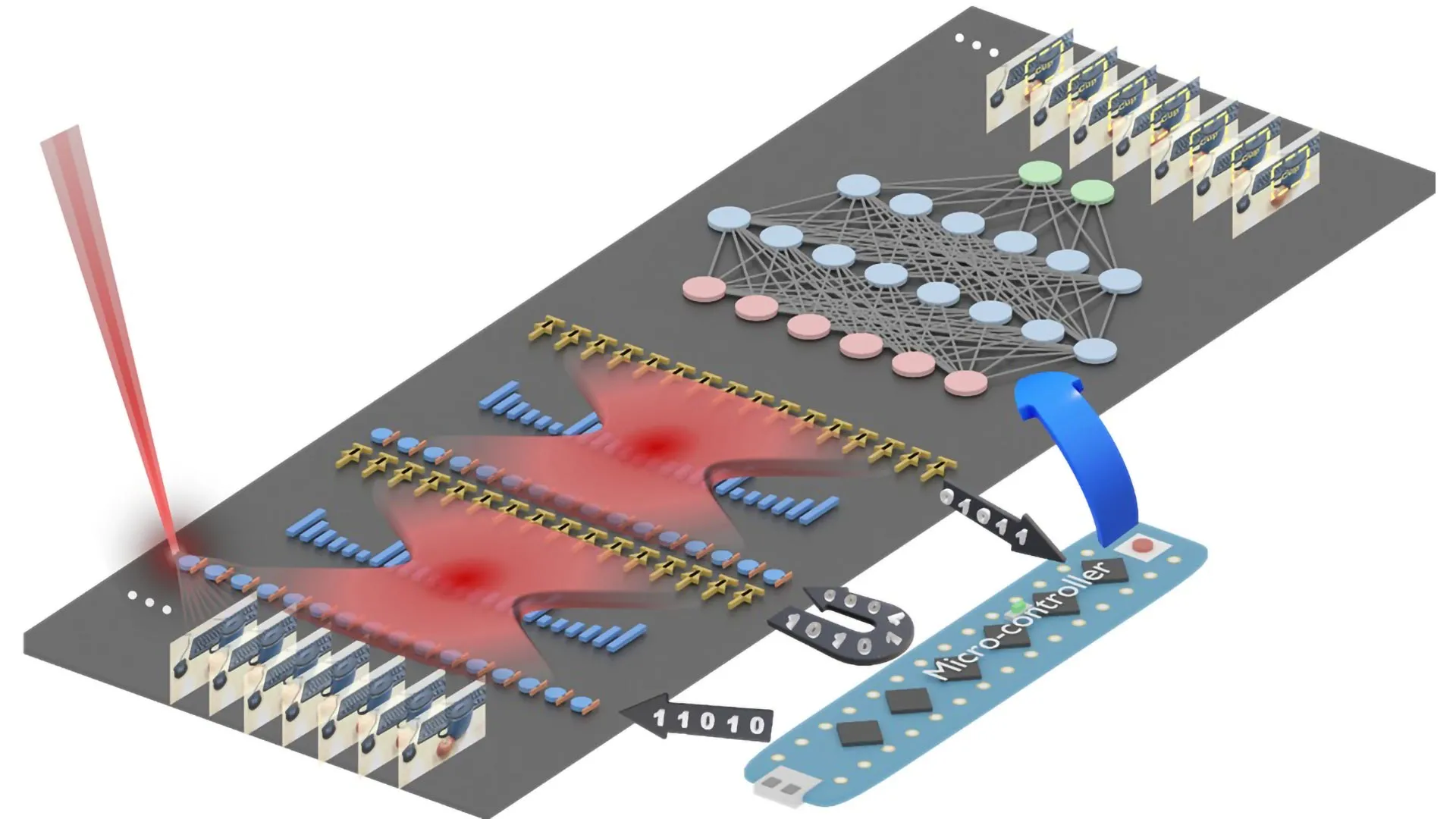
Beyond the issue of reflected signals, even the signals that do reach the receiver directly often lack sufficient precision for the demanding requirements of autonomous driving. This is where the ingenuity of Mohamadi and his team at NTNU truly shines. They have developed a novel system that cleverly integrates several different technologies to correct these degraded signals, culminating in a computer program designed for seamless integration into the navigation systems of autonomous vehicles.
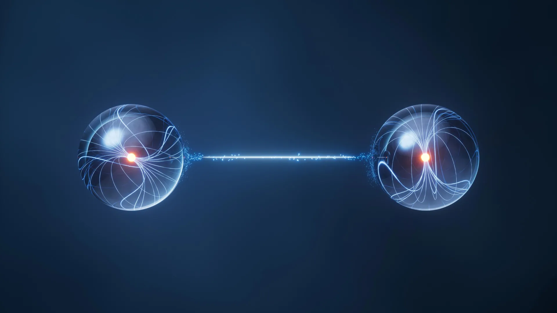
To understand their groundbreaking approach, it’s helpful to briefly revisit how GPS fundamentally works. The Global Positioning System relies on a constellation of satellites orbiting the Earth, continuously broadcasting radio wave signals. A GPS receiver, such as the one in your smartphone, picks up these signals. By receiving signals from at least four satellites, the receiver can triangulate its position on Earth. Each signal contains crucial information: the satellite’s precise location in space and the exact time the signal was transmitted. Think of it as a precise timestamped message from each satellite.
The problem in urban canyons is that this timestamped message can be corrupted by signal reflections. The NTNU researchers explored a radical idea: what if they could bypass the corrupted code altogether and instead focus on the inherent properties of the radio wave itself? This led them to investigate the "carrier phase" of the wave. The carrier phase provides information about whether the wave is traveling upwards or downwards when it reaches the receiver. "Using only the carrier phase can provide very high accuracy, but it takes time, which is not very practical when the receiver is moving," Mohamadi explains. The issue here is that obtaining a precise reading requires the receiver to remain stationary for an extended period, sometimes several minutes, which is entirely unfeasible for a moving vehicle.
Traditional methods for improving GPS accuracy often involve external correction services. One such method is Real-Time Kinematics (RTK), which utilizes a network of ground-based reference stations to send correction data to the receiver. While RTK can achieve centimeter-level accuracy, it is typically expensive and designed for professional users, requiring close proximity to a base station. Another advanced technique is Precise Point Positioning – Real-Time Kinematic (PPP-RTK), which combines precise corrections with satellite signals. The European Galileo system now offers this capability with free broadcasting of corrections, making it more accessible. However, even these advancements faced limitations in the complex urban environment.
The breakthrough came when the researchers began to leverage the immense data and sophisticated algorithms being developed by technology giants. While the NTNU team was refining their methods, Google launched a significant new service for its Android customers. This service involves the creation of highly detailed 3D building models for nearly 4,000 cities worldwide. These intricate digital replicas allow Google to predict precisely how satellite signals will interact with the urban landscape, including reflections and blockages. "They combine data from sensors, Wi-Fi, mobile networks and 3D building models to produce smooth position estimates that can withstand errors caused by reflections," Mohamadi notes, highlighting the power of this multi-faceted approach. This allows apps to overcome the frustrating "wrong-side-of-the-street" problem, where a GPS might incorrectly place you on the opposite side of a road due to signal reflections.
The NTNU researchers then ingeniously integrated these advanced Google data streams with their own developed algorithms and the aforementioned PPP-RTK corrections. This synergistic approach allowed them to overcome the limitations of individual technologies. When they tested their combined system on the streets of Trondheim, the results were nothing short of remarkable. They achieved an accuracy of better than ten centimeters, 90 percent of the time. This level of precision is considered highly reliable for navigation in challenging urban environments, providing the confidence and safety required for autonomous vehicles.
Furthermore, the utilization of PPP-RTK, enhanced by the accessibility of free Galileo corrections and the integration of Google’s 3D mapping data, makes this advanced positioning technology potentially accessible to the general public. "PPP-RTK reduces the need for dense networks of local base stations and expensive subscriptions, enabling cheap, large-scale implementation on mass-market receivers," Mohamadi concludes. This signifies a pivotal shift, moving high-precision navigation out of the realm of professional use and into the hands of everyday consumers, promising a future where our urban journeys are guided with unprecedented accuracy and reliability, transforming how we interact with our cities and paving the way for truly ubiquitous autonomous systems.